Artificial Intelligence and Computer Vision.
Behind the Scenes
Oracle MadHacks is a significant global competition that seeks to harness technology through innovative solutions crafted by participants from around the world.
The competition’s primary objective was to leverage Artificial Intelligence in developing solutions that address various customer requirements within a specific industry. In this instance, the chosen industry was agribusiness.
The Solution
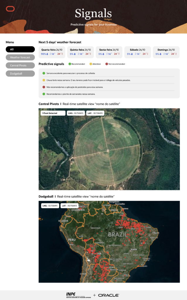
In my quest for a first-place victory in the competition, I conceptualized a groundbreaking solution aimed at empowering farmers with invaluable insights and predictive scenarios through satellite imagery. This innovative approach involved harnessing the power of Artificial Intelligence, Computer Vision, and other cutting-edge technologies intricately linked to the natural satellites orbiting in space.
The competition’s thematic focus encompassed addressing critical agricultural challenges, including optimizing central irrigation systems, forecasting wildfires, assessing soil health, offering insights for optimal fertilizer application timing, and providing accurate weather forecasts.
To craft our objectives, I conducted in-depth interviews with farmers in Brazil and collaborated with renowned agricultural research institutions like Embrapa and others. This meticulous investigative phase culminated in the identification and mapping of the core challenges facing the agricultural sector. Subsequently, we embarked on the journey to develop a comprehensive solution, beginning with the conceptualization of the user interface (prototype) and progressing to its functional implementation. Our solution seamlessly integrated advanced technologies with data from orbiting satellites.
A pivotal moment in our journey occurred when I visited INPE – Instituto Nacional de Pesquisas Espaciais in São José dos Campos. They graciously accepted our challenge and granted us access to Brazilian satellites, enabling us to enhance our solution significantly. Consequently, we successfully integrated data from natural satellites into our solution via APIs, elevating its capabilities to an unprecedented level.
Realizing the Potential: Leveraging Satellite Imagery for Innovative Solutions